

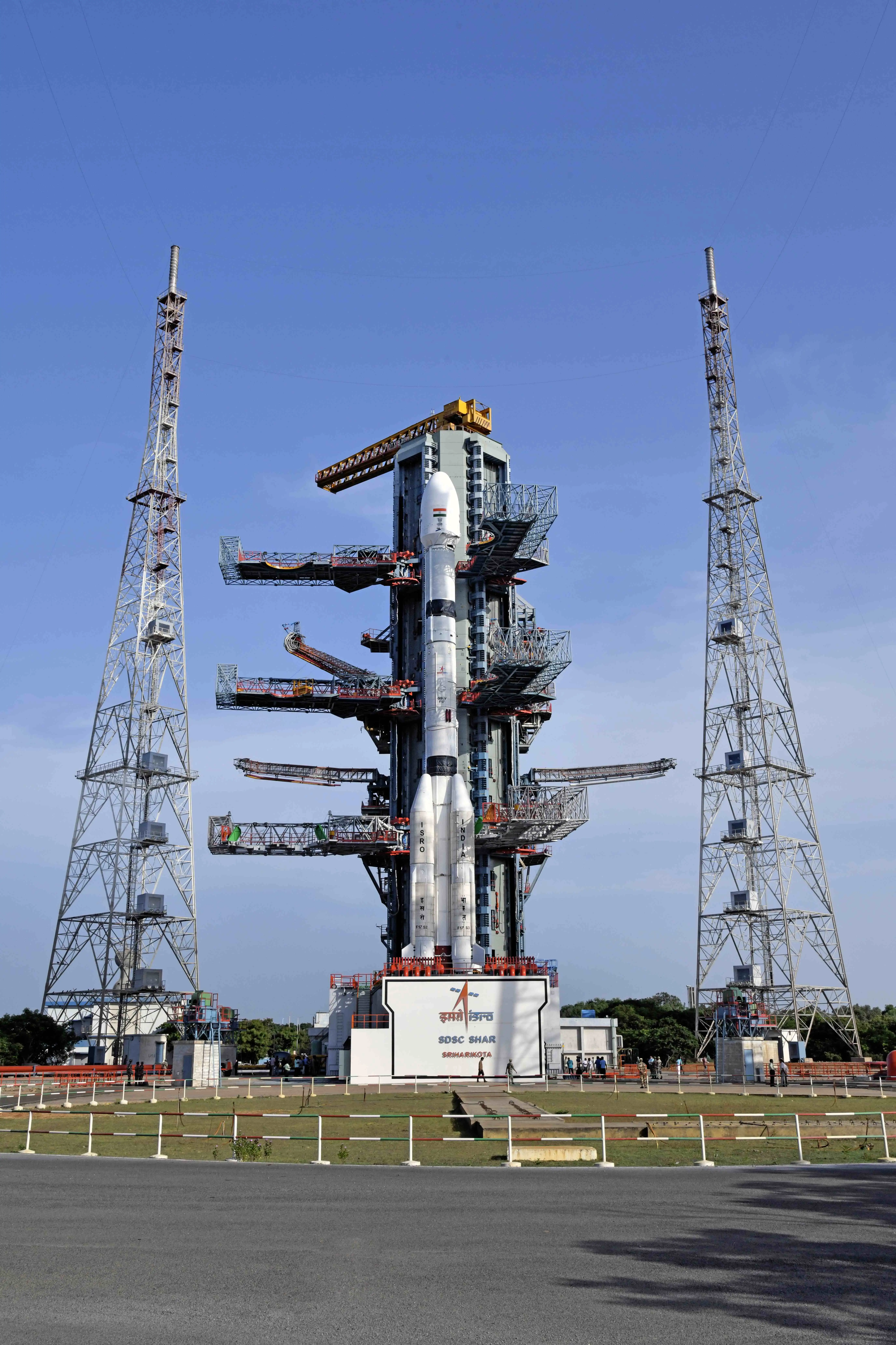
On 12 August 2021, GSLV-F10 lifted off from Sriharikota with GISAT-1 on top. The solid core, the strap-ons and the second stage all performed to prediction. Then, 297.3 seconds in, the cryogenic upper stage began deviating from its expected performance, and ten seconds after that the onboard computer called the abort.
ISRO's failure report, published the following March, traced it to a leaking valve seal on the liquid hydrogen tank. The tank was under-pressurised when the engine was commanded to start, the fuel booster turbo pump inside it malfunctioned, and the thrust chamber never got enough hydrogen. V. Narayanan, now ISRO's chairman, later put the pressure shortfall at 50 millibar.
Fifty millibar. The satellite itself, as far as anyone knows, was perfectly fine.
Five years later, ISRO is going to try again. Sometime in the first week of September, a GSLV Mk II is meant to fly EOS-05, which almost everyone still calls GISAT-1A. Late August reporting pointed at the 4th, and launch trackers now carry a T-0 of 3 September 21:25 UTC with a four hour window, which puts liftoff in the small hours of the 4th Indian time.
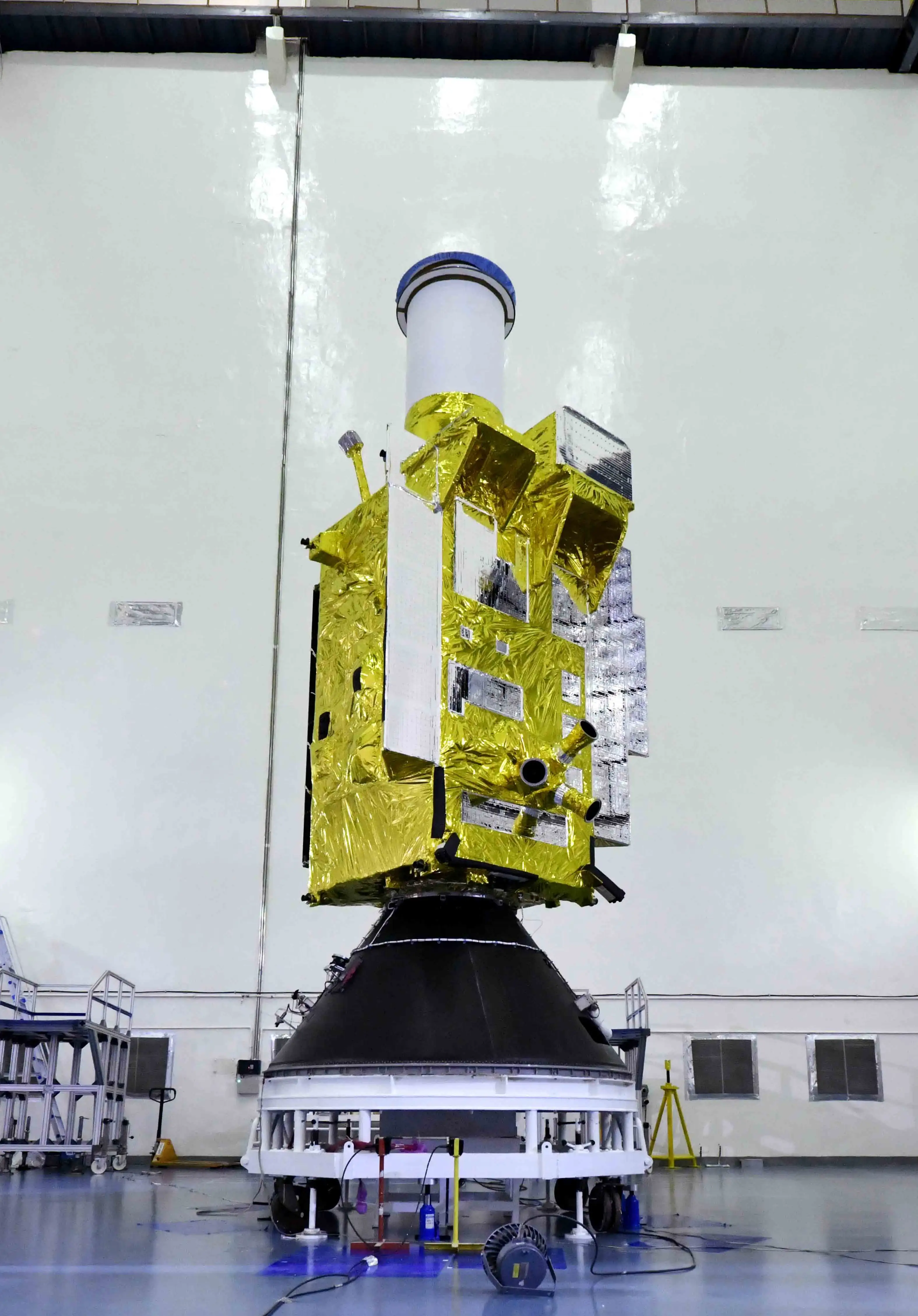
But set the schedule politics aside. GISAT is worth understanding on its own terms, because it is a strange satellite, and the thing that makes it strange is also the thing that has kept it on the ground for eleven years.
Why the orbit is the whole story
Almost everything India flies for imaging sits low. Cartosat, RISAT, Resourcesat, EOS-04, all of them loop around at a few hundred kilometres, and any given point on the ground gets maybe two passes a day lasting a few minutes each. The pictures are sharp. The coverage is not continuous, and there is nothing you can do about that short of launching more satellites.
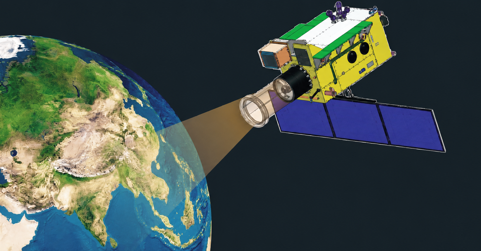
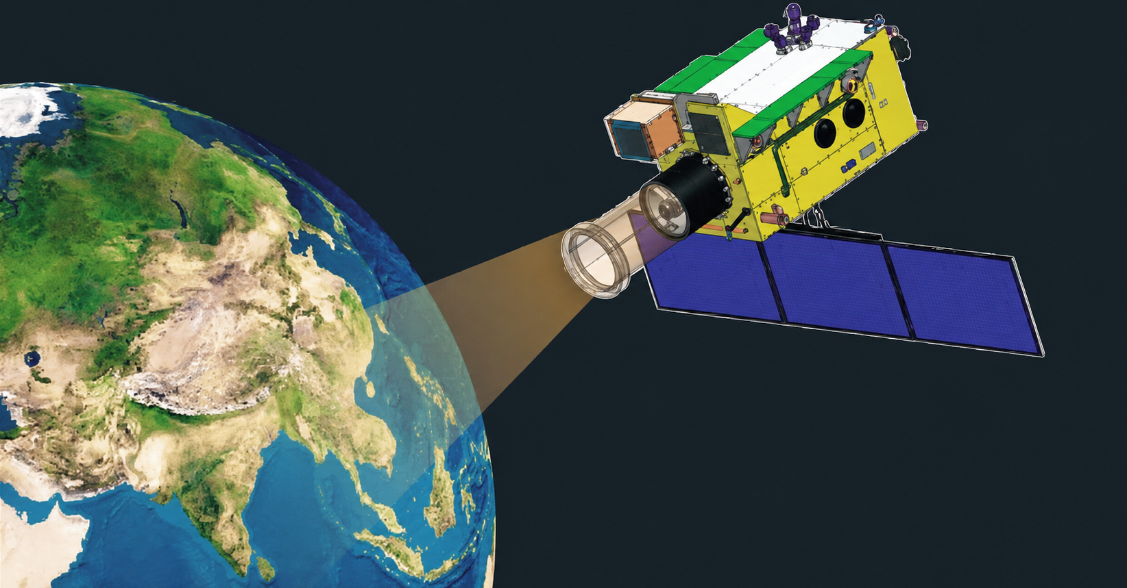
GISAT goes the other way entirely. It will sit at 35,786 km, geostationary, parked over one longitude, watching the same piece of the planet without ever looking away. ISRO's design target is a selected area imaged every five minutes and the whole Indian landmass every half hour.
Most coverage of this satellite leads with the 42 metre figure. I think that is the wrong number to lead with, for reasons I will get to.
What is actually on board
Three imaging systems, all looking through one telescope. These are the numbers published for the original GISAT-1:
Instrument | Channels | Ground resolution | Spectral range |
Multispectral VNIR | 6 | 42 m | 0.45 to 0.875 µm |
Hyperspectral VNIR | 158 | 318 m | 0.375 to 1.0 µm |
Hyperspectral SWIR | 256 | 191 m | 0.9 to 2.5 µm |
Read that table with care, because it is not a specification for the satellite on the pad. Those numbers describe GISAT-1, the spacecraft destroyed in 2021, and they are usually credited to ISRO's GSLV-F10 mission brochure. That attribution appears to be wrong. The actual F10 brochure lists no instruments at all. It gives three mission objectives, a power figure of 2,280 W and a ten year mission life, and stops there. The channel counts and resolutions almost certainly trace to NRSC's 2016 User Interaction Meet presentation instead, which is a considerably weaker source than a mission brochure and is worth knowing if you are citing them.
The telescope is a 700 mm Ritchey-Chretien, adapted from the Cartosat-2A design. Behind it are area-array detectors rather than the pushbroom linear arrays that low-orbit imagers use, and there is a good reason for that: a pushbroom sensor relies on the satellite's own orbital motion to sweep the ground past a single line of pixels. A satellite that is holding still has no such motion to exploit, so it has to capture entire frames at once, the way an ordinary camera does. Getting the data down is handled by an electronically steerable phased array antenna, which matters more than it sounds like it should, because "near real time" imaging is worth nothing if the pictures queue up waiting for a downlink pass.
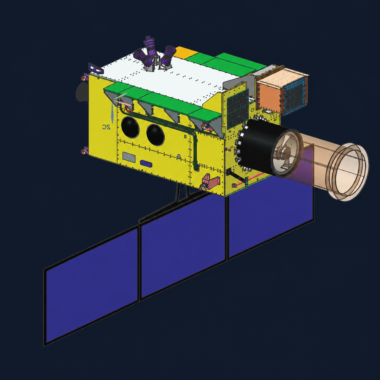
ISRO's mission brochure, out on 29 August, settles one number that had been circulating in three different versions. EOS-05 has a payload mass of about 2,367 kg. That is roughly a hundred kilograms heavier than EOS-03, which is worth registering on its own, because it means this is not simply the 2021 satellite rebuilt to the same drawing.
Beyond the mass, the brochure says very little. ISRO describes EOS-05 as a state of the art Earth observation spacecraft and India's first imaging satellite from geosynchronous orbit, and that is the whole description. Set it beside the 2021 brochure for EOS-03 and the difference is stark. That document gave three specific objectives, near real time imaging of large areas, quick monitoring of natural disasters and episodic events, and spectral signatures for agriculture, forestry and water bodies. It gave a power figure and a ten year mission life. The 2026 brochure gives none of that.
Which does settle one thing. The seven year design life that circulates for this satellite class does not come from ISRO. Their own brochure says ten.
An open question about what EOS-05 actually is
This next part is speculation and I want to label it clearly as such, but the public record does not hang together, and it is worth putting on the table.
The GISAT programme was described from the start as two satellites with different jobs. GISAT-1 was civilian. GISAT-2 was to differ in capability, and a Times of India report in May 2022, backed by a Ministry of Defence Demands for Grants document, said the Navy would acquire it for maritime surveillance in the Indian Ocean Region.
The problem is the designation. Wikipedia's GEO Imaging Satellite article states in its prose that the second satellite, EOS-05, is GISAT-2 and is the Navy acquisition. Its own launch table, on the same page, lists EOS-05 as GISAT-1A and puts GISAT-2 separately in 2027. Those two statements cannot both be right. Current reporting has settled on the second reading, treating EOS-05 as GISAT-1A, a civilian replacement for what was lost, and that is very likely correct.
Two things sit slightly awkwardly against it. The 2026 brochure gives a payload mass of 2,367 kg where EOS-03 is generally listed at 2,268 kg, so this spacecraft is about a hundred kilograms heavier than the one it replaces. And where the 2021 brochure described objectives, power and mission life, this one drops all three and describes the spacecraft in a single sentence.
I want to be careful not to make more of that than it holds. Neither brochure lists instruments, so the silence on payload in 2026 is not a departure from what ISRO did in 2021. A hundred kilograms is comfortably inside what five years of redesign, updated avionics, or a heavier propellant load would explain, and given the sub-GTO insertion the propellant explanation is the obvious one. Brochures vary in how much they disclose.
Still, the honest position is that nobody outside ISRO currently knows what is inside EOS-05. The instrument table everyone is reproducing, this post included, describes a satellite that no longer exists. If the payload has changed, whether that means added thermal capability, a different band allocation, or something not being discussed, we will only find out from the post-commissioning release, if there is one. That is worth watching for on its own.
The hard part
Everything about imaging gets worse when you move the camera from 500 km to 35,786 km, and it gets worse in ways that compound.
Start with the ceiling that physics puts on you. The Rayleigh criterion says the finest angular detail an aperture can resolve is 1.22 λ/D. Put a 700 mm mirror and 550 nm light into that and you get about 0.96 microradians, which at geostationary distance works out to roughly 34 metres on the ground. So GISAT's 42 m is already within touching distance of what its optics can physically deliver. No amount of processing gets around this. If you want sharper, you need a bigger mirror, and a bigger mirror means more mass, and mass headed for geostationary transfer orbit is about the most expensive thing you can buy. Ten metres from GEO wants a mirror about 2.4 metres across. One metre wants roughly 24 metres, which nobody has built or is likely to.
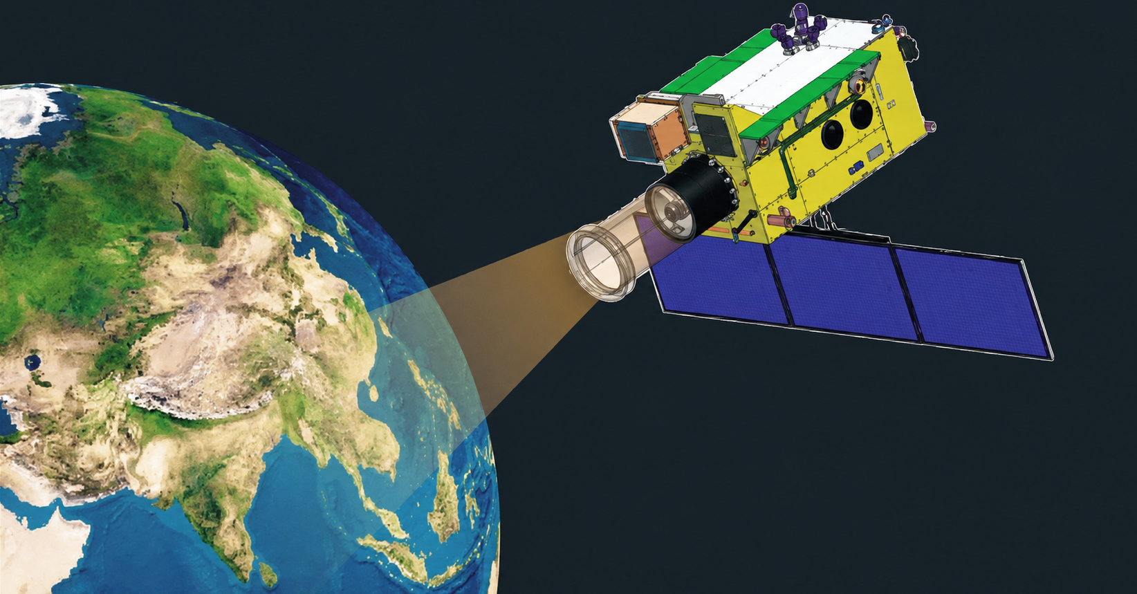
Jitter. Any wobble in where the telescope is pointing that exceeds a fraction of a pixel width smears the image, and at this distance the angular error corresponding to a single 42 m pixel is about 1.17 microradians. Set that next to the 0.96 microradian diffraction limit above and you can see how little slack there is: the pixel is barely wider than the blur the optics already impose. Reaction wheels, cryocooler pistons, thruster pulses, solar array drive motors, and the structural snap of the spacecraft crossing into and out of eclipse all inject vibration at exactly that scale. ISRO's own material describes GISAT as needing a "high agility, jitter-free platform," which is a short phrase covering an enormous amount of engineering: isolation mounts, structural design, and attitude control holding sub-microradian stability.
And it has to do that while constantly repointing. A staring imager with a typical field of view sees something like 400 km by 400 km at a time, so covering a subcontinent every thirty minutes means slewing more or less continuously. Every slew excites structural modes that then have to settle before you can start another exposure. Settle time eats directly into your revisit rate. Building a spacecraft that is both quick to move and completely still a second later is one of the genuinely difficult problems in this class of mission, and it is not a problem that low-orbit imagers have in the same form.
A couple of smaller things worth knowing. India runs from roughly 8 to 37 degrees north, and a satellite parked over the equator is looking at Kashmir through a lot more atmosphere than it looks at Kanyakumari through. Scattering and haze scale with that path length, so the effective resolution degrades as you go north. The 42 m figure is a nadir number. Performance over the Himalayas will be worse than that. Separately, geostationary orbit has no atmospheric drag but also sits outside the shielding that low orbit gets, so detectors take radiation damage faster, and the eclipse seasons drag the optical bench through thermal cycles that distort the mirror figure. Holding focus through all of that is its own design problem.
Where India actually stands
This is the uncomfortable section.
China has been doing this for a decade and is well ahead. Gaofen-4 went up in December 2015 and sits at 105.5 degrees east, doing 50 m in visible and near infrared and 400 m in mid-wave infrared, covering a 7,000 by 7,000 km box in 400 km scenes with revisit measured in minutes. On paper GISAT-1A's 42 m beats it. In practice they are the same generation of instrument, except one of them has ten years of operational data behind it and the other has not launched.
Gaofen-4 is also no longer China's best by some distance. Gaofen-13 went up in October 2020 and Gaofen-13-02 in March 2023, both classified, both assessed by outside analysts at somewhere around 15 m with noticeably larger optics. In August 2023 came Ludi Tance-4, which is still the only synthetic aperture radar satellite anyone has put in geostationary orbit, at roughly 20 m. Radar works through cloud and at night, which removes the single largest weakness of any optical GEO imager.
And then Yaogan-41, launched on a Long March 5 in December 2023, which US Space Force officials have publicly described as achieving around 2.5 m.
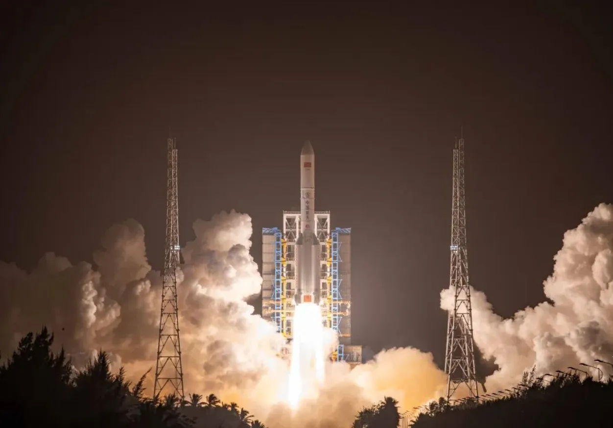
I would be careful with that figure. Run the diffraction math in reverse and 2.5 m from geostationary orbit in visible light needs an aperture somewhere around nine metres. Even the commonly cited estimate of a four metre primary, inferred from the oversized fairing on that launch, only gets you to about 6 m by Rayleigh. Other analysts have noticed the same gap. Something in the 6 to 12 m range seems more defensible than 2.5. It hardly matters for the conclusion, though: any of those numbers is several times better than what India will have in orbit this year, and the satellite is looking at the Indian Ocean.
Europe has essentially chosen not to compete here. There is no European geostationary land imager and there never has been one. The nearest thing is Meteosat Third Generation, and MTG is a weather satellite: the Flexible Combined Imager does 16 channels at 1 km for solar bands and 2 km for thermal, full disc every ten minutes, with a rapid scan mode covering a quarter of the disc every 2.5 minutes at 0.5 km on two channels. Comparing 500 m against 42 m makes India look wildly ahead, but the comparison is meaningless, because MTG is imaging the entire Earth for meteorology and GISAT is imaging one country. FCI's aperture is about 300 mm against GISAT's 700 mm, which tells you the two instruments were never trying to do the same thing. ESA did study a high resolution GEO imager, GeoOculus, in the 10 to 40 m class, and never funded it to flight.
The United States is in a similar position. GOES is weather. The one American instrument that belongs in this conversation is TEMPO, flown as a hosted payload on Intelsat 40e in April 2023, a UV-visible grating spectrometer running about 2 km by 4.7 km, hourly, for air quality.
Which brings me to the thing I think is actually the story here.
Nobody has yet flown a hyperspectral instrument in geostationary orbit that images the land surface at sub-kilometre resolution. That claim needs stating carefully, because GEO hyperspectral instruments do exist and someone will point that out. Korea's GEMS, launched on GEO-KOMPSAT-2B in February 2020, is generally credited as the first hyperspectral instrument in geostationary orbit, and TEMPO and ESA's Sentinel-4 complete that trio. But all three are atmospheric spectrometers reading trace gases at kilometre scale, not surface imagers. The finest imager currently in GEO is Korea's GOCI-II at 250 m, and that is a multispectral ocean colour sensor rather than a hyperspectral one.
GISAT-1A's 158 VNIR channels at 318 m and 256 SWIR channels at 191 m land in the gap between those two categories. Gaofen-4 has no hyperspectral capability at all. For anything you would want to track hour by hour rather than fortnight by fortnight, crop stress, soil moisture, water quality, mineralogy, pollution plumes, this is new ground.
So: the headline number is not 42 metres. It is 414 spectral channels.
There is one clear gap on the other side of the ledger. GISAT-1A carries no thermal band, which makes it a daylight instrument. Gaofen-4 has had a 400 m mid-wave infrared channel since 2015, and that buys night coverage and thermal ship detection over open water. India's thermal capability is deferred to GISAT-2, the version reportedly being picked up by the Navy with LWIR added, currently indicated for 2027. Until that flies, India gets half a day of geostationary coverage and China gets all of it.
What it buys
The civilian case is the one ISRO leads with and it is straightforward enough: disaster response, agriculture, forestry, water resources, and the ability to eventually catch a cloud-free window during monsoon just by imaging often enough that you get lucky.
On defence, it is worth being blunt about what 42 m means, because a lot of coverage is not. That is roughly half a football field per pixel. You will not be identifying a tank, an aircraft, or a truck. What you get instead is persistent wide-area watch and, more usefully, cueing. Low orbits are published and predictable, and activity gets timed around the pass windows accordingly. A satellite that never moves takes that option away. It flags that something has changed across a large area, and then you point Cartosat-3 or a RISAT at the specific place. Wide sensor cues narrow sensor, which is how every operator of these things uses them, China included.
The Navy variant is the more interesting one, and thermal is the reason. A ship sitting on cold water is a warm object with high contrast, so thermal detection works at coarse resolution in a way that land targets never will.
What to watch after it flies
The launch is the short part, and GSLV comes into it off four consecutive successes since 2021. What matters for the satellite is where the rocket lets go of it.
GSLV-F17 is not aiming for a standard geostationary transfer orbit. The target is 170 km by 28,934 km, inclined 19.28 degrees. Geostationary altitude is 35,786 km, so EOS-05 is being released roughly 6,850 km short of where a normal transfer orbit would put its apogee. EOS-03 in 2021 got a full GTO. This one does not, and at 2,367 kg it is heavier than anything GSLV has previously delivered to that orbit, which is the obvious explanation.
The consequence lands entirely on the satellite. EOS-05 has to raise its own apogee across that gap, circularise, and remove more than 19 degrees of inclination on its own propulsion, which is a bigger job than a geostationary satellite normally inherits. The orbit raising campaign should run longer than the few days a comfortable insertion would need, and every kilogram of propellant spent making up the shortfall is a kilogram unavailable for station keeping later. That is a direct claim on how long the satellite stays useful. Watch how many apogee burns ISRO reports and how quickly it settles.
EOS-03 was headed for 85.5 degrees east. ISRO has not said publicly where EOS-05 is going, and where it parks will tell you a fair amount about what it is meant to be looking at.
After that come solar array deployment, the phased array antenna, and thermal stabilisation of the optical bench, which cannot be rushed because the optics need to reach equilibrium and hold focus. First images somewhere between two weeks and two months out would be normal, and expect a multispectral scene rather than anything hyperspectral.
The hyperspectral channels are the real test, and I suspect this is where the story will actually be decided. The 42 m multispectral band is well-understood engineering that ISRO has flown variants of before. The 158 VNIR and 256 SWIR channels are the part nobody has operated from geostationary orbit, and they are precisely the part most exposed to the physics above, because each narrow channel is collecting a thin slice of an already faint signal. Long integration times, low photon counts and residual jitter all hit hyperspectral harder than they hit anything else. If those bands come back noisy or with degraded effective resolution, the genuinely novel capability quietly evaporates while the mission is still, correctly, called a success.
Watch also for whether ISRO publishes real numbers this time. The public specifications are still contradictory on mass, on mission life, and on whether the payload matches EOS-03 at all. A proper post-commissioning release, and actual data availability through NRSC and Bhoonidhi, is what decides whether this becomes a dataset people use or a capability that mostly exists in press releases.
And watch for GISAT-2. One satellite is a demonstration. The thermal-equipped Navy variant, currently indicated for 2027, is what would turn this into a real persistent layer covering night as well as day. GISAT-1A reaching orbit closes a gap that has been open since August 2021. It does not close the gap with what is already parked over the Indian Ocean.
Sources
The 2021 failure
- ISRO, GSLV-F10/EOS-03 Mission Failure: Failure Analysis Committee submits conclusions & recommendations, March 2022, and the GSLV-F10/EOS-03 mission page
- Tribune India, Leaky valve, low pressure led to GSLV failure: ISRO, 26 March 2022, quoting the FAC report directly
- Onmanorama, Why did GSLV-F10 Mission fail? ISRO's Failure Analysis Committee has come up with the answers, March 2022
- The 50 millibar figure comes from V. Narayanan's remarks at VSSC Quality Day, November 2021, reported at the time (Inshorts summary)
This launch
- ISRO Office of Media and Public Relations, GSLV-F17/EOS-05 Mission Brochure, 29 August 2026 (vehicle configuration, flight sequence, sub-GTO parameters, 2,367 kg payload mass)
- ISRO Office of Media and Public Relations, GSLV-F10/EOS-03 Mission Brochure, August 2021 (mission objectives, 2,280 W, ten year design life, F10 flight sequence, GTO target)
- Business Standard, Isro set to end seven-month launch freeze with GISAT-1A in September, 18 August 2026
- Swarajya, ISRO's Seven-Month Launch Gap To End In September With GISAT-1A Mission, August 2026
- Times of India, "Isro to return to launchpad with Gisat-1A; lift-off likely on Sept 4," 28 August 2026 (no stable public URL)
- ISRO, GSLV F10/GISAT-1 mission brochure and Annual Reports 2015-16, 2019-20, 2020-21 (original ISRO links are now dead; archived copies via the Wayback Machine)
China's GEO fleet
- Gunter's Space Page: Gaofen 4, Gaofen 13, Yaogan 41
- CSIS, No Place to Hide: A Look into China's Geosynchronous Surveillance Capabilities
- SpaceNews, Why Space Force is growing more alarmed by China's eyes in the sky, February 2024
- SpaceNews, China launches second classified Gaofen-13 remote sensing satellite, March 2023
- China Space Report, Gaofen series overview
Europe, the US and Korea in GEO
- ESA, Flexible Combined Imager and About Meteosat Third Generation
- EUMETSAT, MTG FCI Level 1c data guide
- eoPortal, Meteosat Third Generation
- NASA Earthdata, New Instrument Provides Hourly Measurements of Atmospheric Pollutants (TEMPO)
- eoPortal, GEO-KOMPSAT-2 (GEMS and GOCI-II)
- WMO OSCAR instrument database: GOCI-II and EOS-03 HyS-VNIR
PSLV-C62
- Newsonair, PSLV-C62 anomaly: ISRO investigates roll disturbance during third stage, January 2026
- Deccan Herald, ISRO's first 2026 mission PSLV-C62 fails, January 2026